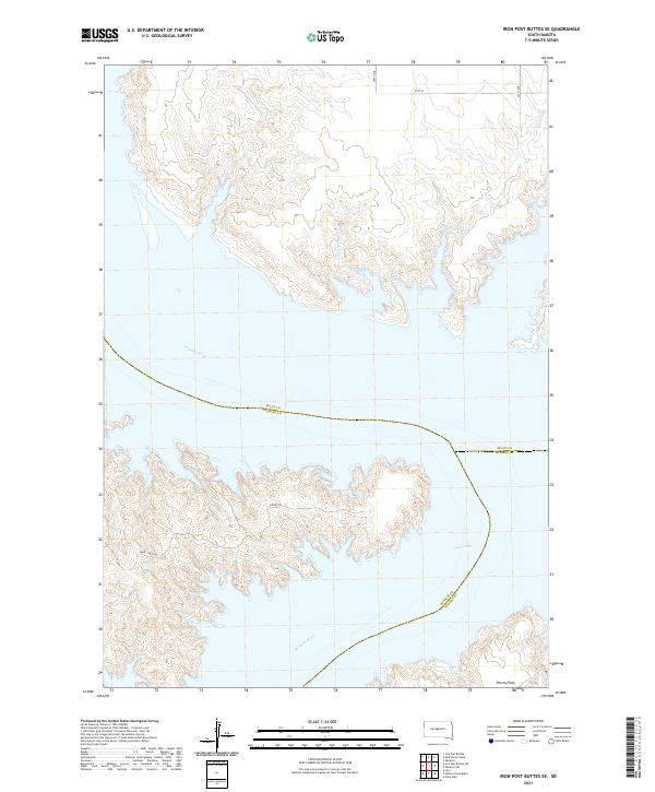
2021 Map of Iron Post Buttes SE
USGS Topo · Published 2021About this map
Lake Oahe and the Missouri River dominate this modern topographic view of the South Dakota prairie, where three counties—Sully, Stanley, and Hughes—meet along the shifting water lines. The landscape is defined by the expansive Peoria Flats and a network of drainages including Sully Cr, Plum Cr, and Red Woman Cr that carve through the river bluffs. This 2021 survey illustrates how the Missouri's course has been transformed into a massive reservoir system, affecting the local topography and access. The map reveals a sparse infrastructure of rural connectors like Gumbo Rd and Snake Creek Rd, which navigate the intricate shoreline and surrounding plateaus. This document is essential for understanding the contemporary geography of this tri-county intersection, showing the land's utility through township and range divisions and its natural character along the reservoir’s edge.
Find a feature on this map
23 named features on this map. Tap any name to fly to it.
Don’t see what you’re looking for? This feature index may not catch every label — zoom into the map to look around manually.
Map Details
Editions of this 2021 Iron Post Buttes SE Map
This is the sole edition of this map. No revisions or reprints were ever made.
Other maps of this area

1924 · Pierre
USGS Topo · 1:62,500

1937 · Oahe
USGS Topo · 1:62,500

1954 · Pierre
USGS Topo · 1:250,000

1958 · Pierre
USGS Topo · 1:250,000

1965 · Okobojo
USGS Topo · 1:24,000
1973 · Iron Post Buttes SE
USGS Topo · 1:24,000

1973 · Iron Post Buttes SW
USGS Topo · 1:24,000

1973 · Iron Post Buttes
USGS Topo · 1:24,000
1973 · Willow Creek Butte
USGS Topo · 1:24,000
1973 · Okobojo SW
USGS Topo · 1:24,000