
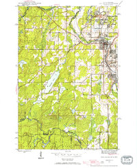
1944 Map of Iron River
USGS Topo · Published 1956About this map
Mining operations dominate this mid-century landscape along the Iron River, where extraction sites like the Forbes Mine, James Mine, and Spies Mine define the local economy. The industrial footprint is extensive, featuring specialized worker settlements such as Virgil Location and Hiawatha Location, alongside the established municipalities of Iron River and Stambaugh. The Chicago and Northwestern railroad network weaves through these mining districts, providing the critical transport links for the region's mineral wealth.
Find a feature on this map
41 named features on this map. Tap any name to fly to it.
Don’t see what you’re looking for? This feature index may not catch every label — zoom into the map to look around manually.
Map Details
Editions of this 1944 Iron River Map
2 editions found
Other maps of this area

1898 · Iron River
USGS Topo · 1:62,500

1938 · Alvin
USGS Topo · 1:48,000

1939 · Long Lake
USGS Topo · 1:48,000

1944 · Gaastra
USGS Topo · 1:24,000

1945 · Gibbs City
USGS Topo · 1:24,000

1945 · Sunset Lake
USGS Topo · 1:24,000

1946 · Iron River
USGS Topo · 1:31,680

1946 · Sunset Lake
USGS Topo · 1:31,680

1946 · Gaastra
USGS Topo · 1:31,680

1946 · Alvin
USGS Topo · 1:48,000