
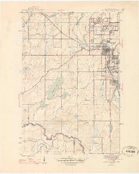
1946 Map of Iron River
USGS Topo · Published 1946About this map
Mining operations and residential company locations define the landscape of the upper Menominee Range during the mid-1940s. The northern portion of the sheet is dominated by the City of Iron River and the neighboring village of Mineral Hills, a hub of heavy industry served by the Chicago and Northwestern rail lines. A dense network of underground workings is evident through labels for the Homer Mine, Wauseca Mine, and the Spies Mine, while residential clusters like Forbes Location and Virgil Location mark the living quarters for the local labor force. To the south, the terrain transitions into the Ottawa National Forest, where the topography softens around Stanley Lake and Plover Lake. This survey captures the region at its industrial peak, just before the post-war shifts began to alter the local economy and the footprint of the mining locations.
Find a feature on this map
44 named features on this map. Tap any name to fly to it.
Don’t see what you’re looking for? This feature index may not catch every label — zoom into the map to look around manually.
Map Details
Editions of this 1946 Iron River Map
2 editions found
Other maps of this area

1898 · Iron River
USGS Topo · 1:62,500

1938 · Alvin
USGS Topo · 1:48,000

1939 · Long Lake
USGS Topo · 1:48,000

1944 · Iron River
USGS Topo · 1:24,000

1944 · Gaastra
USGS Topo · 1:24,000

1945 · Gibbs City
USGS Topo · 1:24,000

1945 · Sunset Lake
USGS Topo · 1:24,000

1946 · Sunset Lake
USGS Topo · 1:31,680

1946 · Gaastra
USGS Topo · 1:31,680

1946 · Alvin
USGS Topo · 1:48,000