
1958 Map of Iron River
USGS Topo · Published 1968About this map
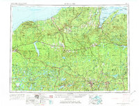
The Ottawa National Forest and Baraga State Forest dominate this mid-century landscape of Michigan’s Upper Peninsula. The map reveals a region defined by its connection to Lake Superior and a robust inland timber and rail infrastructure. Settlements like Ontonagon and L'Anse serve as coastal anchors, while interior communities such as Mass Station and Covington are linked by the Chicago Milwaukee St Paul and Pacific and the Duluth South Shore and Atlantic railroads.
Find a feature on this map
201 named features on this map. Tap any name to fly to it.
Don’t see what you’re looking for? This feature index may not catch every label — zoom into the map to look around manually.
Map Details
Editions of this 1958 Iron River Map
3 editions found
Other maps of this area

1895 · Ned Lake
USGS Topo · 1:62,500

1895 · Perch Lake
USGS Topo · 1:62,500

1898 · Iron River
USGS Topo · 1:62,500

1899 · Sagola
USGS Topo · 1:62,500

1899 · Witbeck
USGS Topo · 1:62,500

1899 · Crystal Falls
USGS Topo · 1:62,500

1915 · Houghton
USGS Topo · 1:62,500

1928 · Three Lakes
USGS Topo · 1:48,000

1930 · Robbins
USGS Topo · 1:48,000

1938 · Phelps
USGS Topo · 1:48,000