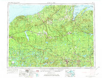
1958 Map of Iron River
USGS Topo · Published 1974About this map
L'Anse Indian Reservation and the coastal communities of Keweenaw Bay anchor the northeastern reach of this Lake Superior region. The landscape is defined by extensive timberlands and managed forests, including the Ottawa National Forest and Baraga State Forest, where early resource extraction shaped the local economy. The copper-mining legacy of the Upper Peninsula is evident near White Pine and Ontonagon, while the western edge is dominated by the elevations of Porcupine Peak within Porcupine Mountains State Park.
Find a feature on this map
176 named features on this map. Tap any name to fly to it.
Don’t see what you’re looking for? This feature index may not catch every label — zoom into the map to look around manually.
Map Details
Editions of this 1958 Iron River Map
3 editions found

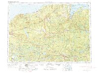
Other maps of this area

1895 · Ned Lake
USGS Topo · 1:62,500

1895 · Perch Lake
USGS Topo · 1:62,500

1898 · Iron River
USGS Topo · 1:62,500

1899 · Sagola
USGS Topo · 1:62,500

1899 · Witbeck
USGS Topo · 1:62,500

1899 · Crystal Falls
USGS Topo · 1:62,500

1915 · Houghton
USGS Topo · 1:62,500

1928 · Three Lakes
USGS Topo · 1:48,000

1930 · Robbins
USGS Topo · 1:48,000

1938 · Phelps
USGS Topo · 1:48,000