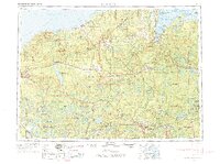
1958 Map of Iron River
USGS Topo · Published 1974About this map
The Porcupine Mtns and the Huron Mtns anchor this expansive survey of the western Upper Peninsula and northern Wisconsin during the late 1950s. The landscape is defined by its industrial and natural intersections, showing the Chicago Milwaukee St Paul and Pacific railroad threading through timberlands and the Ottawa National Forest. Settlements like Ontonagon and L'Anse serve as coastal hubs on the Lake Superior shore, while inland life revolves around the rivers and reservoirs. The presence of Victoria Dam and Prickett Dam highlights the era's focus on hydroelectric power development in the Ontonagon River and Sturgeon River basins. Further south, the map captures the transition into the Nicolet National Forest and the lake-rich borders of the Lac Du Flambeau Indian Reservation. This map provides researchers a view of the region's transport network before the major highway modernizations of the late twentieth century.
Find a feature on this map
112 named features on this map. Tap any name to fly to it.
Don’t see what you’re looking for? This feature index may not catch every label — zoom into the map to look around manually.
Map Details
Editions of this 1958 Iron River Map
3 editions found

Other maps of this area

1895 · Ned Lake
USGS Topo · 1:62,500

1895 · Perch Lake
USGS Topo · 1:62,500

1898 · Iron River
USGS Topo · 1:62,500

1899 · Sagola
USGS Topo · 1:62,500

1899 · Witbeck
USGS Topo · 1:62,500

1899 · Crystal Falls
USGS Topo · 1:62,500

1915 · Houghton
USGS Topo · 1:62,500

1928 · Three Lakes
USGS Topo · 1:48,000

1930 · Robbins
USGS Topo · 1:48,000

1938 · Phelps
USGS Topo · 1:48,000