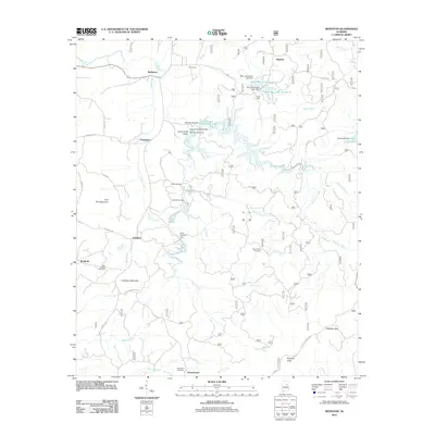
2011 Map of Ironaton
USGS Topo · Published 2011About this map
Ironaton and Chinnabee anchor this part of Talladega County, where the topography of the Appalachian foothills dictates the pattern of settlement and water management. The landscape is defined by a series of dams and reservoirs, including Lake Robin and the C C W Dam Number 6 Lake, which suggest a sophisticated network of water control for local needs. Local history is deeply embedded in the terrain, evidenced by several family or community burial grounds such as Lackey Cemetery and the Seay Chapel Cemetery near Woolfolk.
Find a feature on this map
52 named features on this map. Tap any name to fly to it.
Don’t see what you’re looking for? This feature index may not catch every label — zoom into the map to look around manually.
Map Details
Editions of this 2011 Ironaton Map
This is the sole edition of this map. No revisions or reprints were ever made.
Other maps of this area

1889 · Springville
USGS Topo · 1:125,000

1890 · Talladega
USGS Topo · 1:125,000

1891 · Ashland
USGS Topo · 1:125,000

1892 · Springville
USGS Topo · 1:125,000

1892 · Talladega
USGS Topo · 1:125,000

1900 · Anniston
USGS Topo · 1:125,000

1943 · Talladega
USGS Topo · 1:62,500

1946 · Talladega
USGS Topo · 1:62,500

1947 · Oxford
USGS Topo · 1:24,000

1947 · Eastaboga
USGS Topo · 1:24,000