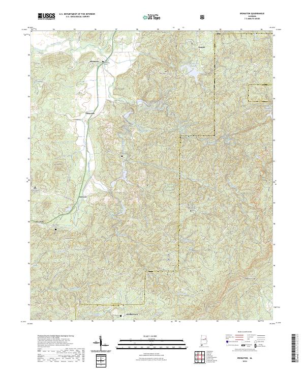
2024 Map of Ironaton
USGS Topo · Published 2024About this map
The Talladega National Forest and the Cheaha Wilderness dominate this landscape on the border of Talladega and Clay Counties. The rugged topography of Talladega Mountain rises in the southeast, punctuated by Burgess Point and Patterson Gap. This modern survey documents several small settlements and rural communities, including Ironaton, Chinnabee, and Woolfolk, many of which grew around early rail lines and agricultural hubs. Notable genealogical landmarks are preserved across the terrain, from the Chief Chenneby Grave near McElderry to the Mount Cavalry Baptist Church Cem. A dense network of creeks, such as Cheaha Creek and Fayne Creek, drains the valley floors, while Lake Chinnabee and Camp Mac Lake Number 1 offer substantial water features within the protected forest areas.
Find a feature on this map
65 named features on this map. Tap any name to fly to it.
Don’t see what you’re looking for? This feature index may not catch every label — zoom into the map to look around manually.
Map Details
Editions of this 2024 Ironaton Map
This is the sole edition of this map. No revisions or reprints were ever made.
Other maps of this area

1889 · Springville
USGS Topo · 1:125,000

1890 · Talladega
USGS Topo · 1:125,000

1891 · Ashland
USGS Topo · 1:125,000

1892 · Springville
USGS Topo · 1:125,000

1892 · Talladega
USGS Topo · 1:125,000

1900 · Anniston
USGS Topo · 1:125,000

1943 · Talladega
USGS Topo · 1:62,500

1946 · Talladega
USGS Topo · 1:62,500

1947 · Oxford
USGS Topo · 1:24,000

1947 · Eastaboga
USGS Topo · 1:24,000