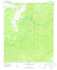
1969 Map of Ironaton
USGS Topo · Published 1974About this map
Ironaton and the surrounding reaches of the Talladega National Forest are captured here in the late 1960s, documenting a landscape defined by industrial history and small mountain communities. The Louisville and Nashville railroad runs along the western edge, connecting the settlements of McElderry and Woolfolk. This rail infrastructure once supported the local iron industry, leaving behind a network of creek-side communities and landmarks like Cemetery Mountain.
Find a feature on this map
40 named features on this map. Tap any name to fly to it.
Don’t see what you’re looking for? This feature index may not catch every label — zoom into the map to look around manually.
Map Details
Editions of this 1969 Ironaton Map
This is the sole edition of this map. No revisions or reprints were ever made.
Other maps of this area

1889 · Springville
USGS Topo · 1:125,000

1890 · Talladega
USGS Topo · 1:125,000

1891 · Ashland
USGS Topo · 1:125,000

1892 · Springville
USGS Topo · 1:125,000

1892 · Talladega
USGS Topo · 1:125,000

1900 · Anniston
USGS Topo · 1:125,000

1943 · Talladega
USGS Topo · 1:62,500

1946 · Talladega
USGS Topo · 1:62,500

1947 · Oxford
USGS Topo · 1:24,000

1947 · Eastaboga
USGS Topo · 1:24,000