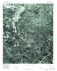
1975 Map of Ironaton
USGS Topo · Published 1977About this map
Mc Elderry and Guntertown mark the primary areas of settlement on this 1975 orthophotoquad, which emphasizes the heavily forested and ridged topography of this part of Talladega County. Unlike traditional topographic maps, this imagery-based study reveals the literal footprint of mid-1970s land use, showing clearings, farm plots, and road networks as they physically existed on the ground. The contrast between the dense, textured woodlands of the eastern portion and the more open, developed valley floor to the west provides an immediate visual record of the region's agricultural and residential boundaries. Produced in cooperation with the Soil Conservation Service, the map serves as a precise photographic document of the landscape before more recent decades of development altered these rural Alabama communities.
Find a feature on this map
2 named features on this map. Tap any name to fly to it.
Don’t see what you’re looking for? This feature index may not catch every label — zoom into the map to look around manually.
Map Details
Editions of this 1975 Ironaton Map
This is the sole edition of this map. No revisions or reprints were ever made.
Other maps of this area

1889 · Springville
USGS Topo · 1:125,000

1890 · Talladega
USGS Topo · 1:125,000

1891 · Ashland
USGS Topo · 1:125,000

1892 · Springville
USGS Topo · 1:125,000

1892 · Talladega
USGS Topo · 1:125,000

1900 · Anniston
USGS Topo · 1:125,000

1943 · Talladega
USGS Topo · 1:62,500

1946 · Talladega
USGS Topo · 1:62,500

1947 · Oxford
USGS Topo · 1:24,000

1947 · Eastaboga
USGS Topo · 1:24,000