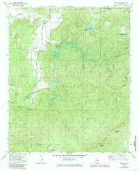
1983 Map of Ironaton
USGS Topo · Published 1985About this map
Ironaton and the surrounding terrain of the Talladega National Forest define this landscape on the border of Talladega and Clay Counties. The map reveals a transition from the agricultural and settlement patterns in the west, where McElderry and Woolfolk sit along a now-abandoned railroad line, to the heavily forested ridges of the east. This industrial and transport history is further evidenced by the series of dams, including Dam No 6 and Dam No 5, which managed water flow through the hills.
Find a feature on this map
39 named features on this map. Tap any name to fly to it.
Don’t see what you’re looking for? This feature index may not catch every label — zoom into the map to look around manually.
Map Details
Editions of this 1983 Ironaton Map
This is the sole edition of this map. No revisions or reprints were ever made.
Other maps of this area

1889 · Springville
USGS Topo · 1:125,000

1890 · Talladega
USGS Topo · 1:125,000

1891 · Ashland
USGS Topo · 1:125,000

1892 · Springville
USGS Topo · 1:125,000

1892 · Talladega
USGS Topo · 1:125,000

1900 · Anniston
USGS Topo · 1:125,000

1943 · Talladega
USGS Topo · 1:62,500

1946 · Talladega
USGS Topo · 1:62,500

1947 · Oxford
USGS Topo · 1:24,000

1947 · Eastaboga
USGS Topo · 1:24,000