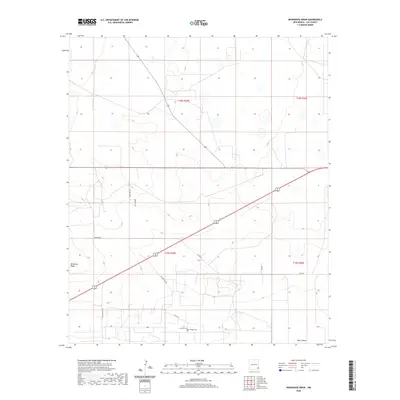
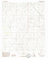
2020 Map of Ironhouse Draw
USGS Topo · Published 2020About this map
Mescalero Ridge defines the western terrain of this Lea County landscape, overlooking a series of rural roads and scattered landmarks typical of the High Plains. The small settlement of Pearl Valley anchors the area, situated near the intersection of several local routes such as Willow Tree Rd and Pearl Valley road. The presence of both Crockett Cem and Morgan Cem provides specific points of interest for genealogists tracing local family history in this corner of New Mexico. To the east, the depression of Red Lake marks a natural drainage feature amidst the extensive township and range survey lines of t19s r35e and t18s r35e. The map illustrates a network of named lanes including Burton Ln and Aquarius Ln, reflecting the modern rural infrastructure of the early 21st century.
Find a feature on this map
16 named features on this map. Tap any name to fly to it.
Don’t see what you’re looking for? This feature index may not catch every label — zoom into the map to look around manually.
Map Details
Editions of this 2020 Ironhouse Draw Map
This is the sole edition of this map. No revisions or reprints were ever made.
Other maps of this area

1954 · Hobbs
USGS Topo · 1:250,000

1958 · Hobbs
USGS Topo · 1:250,000
1962 · Lovington
USGS Topo · 1:62,500
1962 · Buckeye
USGS Topo · 1:62,500
1963 · Monument
USGS Topo · 1:62,500
1963 · Laguna Gatuna
USGS Topo · 1:62,500
1984 · Lea
USGS Topo · 1:24,000
1984 · Ironhouse Well
USGS Topo · 1:24,000
1985 · Monument North
USGS Topo · 1:24,000
1985 · Lovington SE
USGS Topo · 1:24,000