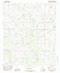
1985 Map of Ironhouse Draw
USGS Topo · Published 1985About this map
Mescalero Ridge (the Caprock) dominates the western landscape of this mid-1980s Lea County survey, marking a significant topographical break in the High Plains. The arid terrain is defined by the ephemeral drainage of Ironhouse Draw, which cuts across the central portion of the sheet toward Pearl Valley in the southeast. This period represents a mature phase of energy extraction in the Permian Basin, evidenced by the extensive Oil Field development and supporting infrastructure, including an Aqueduct system and small water bodies like Red Lake. The mapping highlights the intersection of industrial land use with the natural escarpment of the Llano Estacado, providing a detailed look at the road networks and well sites that supported the regional petroleum economy during the late twentieth century.
Find a feature on this map
6 named features on this map. Tap any name to fly to it.
Don’t see what you’re looking for? This feature index may not catch every label — zoom into the map to look around manually.
Map Details
Editions of this 1985 Ironhouse Draw Map
This is the sole edition of this map. No revisions or reprints were ever made.
Other maps of this area

1954 · Hobbs
USGS Topo · 1:250,000

1958 · Hobbs
USGS Topo · 1:250,000

1962 · Lovington
USGS Topo · 1:62,500

1962 · Buckeye
USGS Topo · 1:62,500

1963 · Monument
USGS Topo · 1:62,500

1963 · Laguna Gatuna
USGS Topo · 1:62,500

1984 · Lea
USGS Topo · 1:24,000

1984 · Ironhouse Well
USGS Topo · 1:24,000
1985 · Monument North
USGS Topo · 1:24,000
1985 · Lovington SE
USGS Topo · 1:24,000