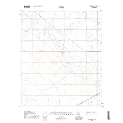
2020 Map of Ironhouse Well
USGS Topo · Published 2020About this map
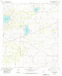
Mescalero Ridge forms the dominant geographic spine of this Lea County landscape, marking a distinct elevation change that defines the area's arid character. This modern USGS study reveals a sparse network of roads with celestial names such as Hercules Ln, Gemini Ln, and Aquila Ln, which intersect the high plains of the Llano Estacado. The presence of Ironhouse Well and the winding course of Ironhouse Draw indicate the critical historical importance of water access in this high desert environment. While largely open ranch land or oil-and-gas territory today, the map preserves the exact Public Land Survey System grid, including townships t18s r34e and t19s r34e, providing a precise framework for researchers tracking land ownership and mineral rights in the Permian Basin region.
Find a feature on this map
15 named features on this map. Tap any name to fly to it.
Don’t see what you’re looking for? This feature index may not catch every label — zoom into the map to look around manually.
Map Details
Editions of this 2020 Ironhouse Well Map
This is the sole edition of this map. No revisions or reprints were ever made.
Other maps of this area

1954 · Hobbs
USGS Topo · 1:250,000

1958 · Hobbs
USGS Topo · 1:250,000
1962 · Lovington
USGS Topo · 1:62,500
1962 · Buckeye
USGS Topo · 1:62,500
1963 · Monument
USGS Topo · 1:62,500
1963 · Laguna Gatuna
USGS Topo · 1:62,500
1984 · Lea
USGS Topo · 1:24,000
1984 · Ironhouse Well
USGS Topo · 1:24,000
1984 · Laguna Gatuna NW
USGS Topo · 1:24,000
1984 · Laguna Gatuna
USGS Topo · 1:24,000