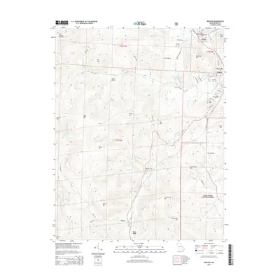
2015 Map of Ironton
USGS Topo · Published 2015About this map
The Saint Francois Mountains define the character of this Missouri landscape, where the concentrated settlements of Ironton, Arcadia, and Pilot Knob cluster near the northeastern corner. This area serves as a gateway to some of the state's most significant natural landmarks, including Taum Sauk Mtn and the nearby Mina Sauk Falls. The terrain is marked by numerous peaks such as Shepherd Mtn and Victory Mtn, with narrow passages like Royal Gorge and Ketcherside Gap influencing the paths of modern roads and old routes alike.
Find a feature on this map
71 named features on this map. Tap any name to fly to it.
Don’t see what you’re looking for? This feature index may not catch every label — zoom into the map to look around manually.
Map Details
Editions of this 2015 Ironton Map
This is the sole edition of this map. No revisions or reprints were ever made.
Other maps of this area

1924 · Edgehill
USGS Topo · 1:62,500

1926 · Edgehill
USGS Topo · 1:62,500

1926 · Des Arc
USGS Topo · 1:62,500

1929 · Des Arc
USGS Topo · 1:62,500

1937 · Ironton
USGS Topo · 1:48,000

1943 · Lesterville
USGS Topo · 1:62,500

1945 · Ironton
USGS Topo · 1:62,500

1946 · Lesterville
USGS Topo · 1:62,500

1946 · Ironton
USGS Topo · 1:62,500

1949 · Rolla
USGS Topo · 1:250,000