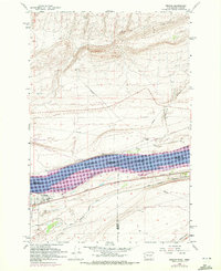
1962 Map of Irrigon
USGS Topo · Published 1972About this map
Irrigon stands as a central hub on the southern banks of the Columbia River in this early 1960s survey. The landscape is defined by the massive expansion of Lake Umatilla following the construction of downriver dams, which submerged portions of the original shoreline and relocated earlier infrastructure. Transportation is a primary theme of the sheet, with the Union Pacific and Burlington Northern railroads paralleling the water, while the West Extension Canal winds through the southern fields to support local agriculture. Regional heritage is preserved through landmarks like the Houghton Sch and a local Cem, while the John Day Wildlife Management Area occupies the river's northern banks. The inclusion of the Compressor Station and various pipelines highlights the industrial energy corridor developing along the river during this era.
Find a feature on this map
20 named features on this map. Tap any name to fly to it.
Don’t see what you’re looking for? This feature index may not catch every label — zoom into the map to look around manually.
Map Details
Editions of this 1962 Irrigon Map
3 editions found
Other maps of this area

1906 · Blalock Island
USGS Topo · 1:125,000

1908 · Blalock Island
USGS Topo · 1:125,000

1908 · Umatilla
USGS Topo · 1:125,000

1915 · Prosser
USGS Topo · 1:125,000

1917 · Pasco
USGS Topo · 1:125,000

1917 · Prosser
USGS Topo · 1:125,000

1953 · Pendleton
USGS Topo · 1:250,000

1953 · Walla Walla
USGS Topo · 1:250,000

1956 · Pendleton
USGS Topo · 1:250,000

1958 · Walla Walla
USGS Topo · 1:250,000