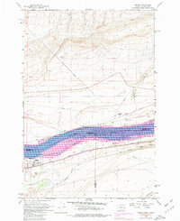
1962 Map of Irrigon
USGS Topo · Published 1980About this map
The town of Irrigon serves as the hub of this 1962 riverfront survey, positioned at the intersection of rail commerce and agricultural expansion. This map captures the mid-century landscape of the Mid-Columbia region, dominated by the waters of Lake Umatilla and the Columbia River. The presence of the West Extension Irrigation Canal illustrates the technological efforts to reclaim the arid land for farming, while the Burlington Northern Railroad and Union Pacific Railroad bracket the river, highlighting the area's role as a vital transportation corridor.
Find a feature on this map
19 named features on this map. Tap any name to fly to it.
Don’t see what you’re looking for? This feature index may not catch every label — zoom into the map to look around manually.
Map Details
Editions of this 1962 Irrigon Map
3 editions found
Other maps of this area

1906 · Blalock Island
USGS Topo · 1:125,000

1908 · Blalock Island
USGS Topo · 1:125,000

1908 · Umatilla
USGS Topo · 1:125,000

1915 · Prosser
USGS Topo · 1:125,000

1917 · Pasco
USGS Topo · 1:125,000

1917 · Prosser
USGS Topo · 1:125,000

1953 · Pendleton
USGS Topo · 1:250,000

1953 · Walla Walla
USGS Topo · 1:250,000

1956 · Pendleton
USGS Topo · 1:250,000

1958 · Walla Walla
USGS Topo · 1:250,000