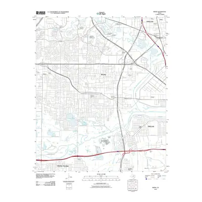
2010 Map of Irving
USGS Topo · Published 2010About this map
The Elm Fork Trinity River and West Fork Trinity River converge within this urban corridor, defining the boundaries between Irving, Dallas, and Grand Prairie. This 2010 survey documents a densely developed landscape where modern infrastructure like the Lake Carolyn Levee and Central Regional Wastewater System sit alongside historical touchstones. Local heritage is preserved in several burial grounds, including the Sowers Cemetery and Letot Cemetery, which predate the surrounding suburban sprawl. The map captures the significant hydrological management of the region, from the California Crossing Dam to the industrial character of Chalk Hill and the former crossing point at Eagle Ford. Notable educational and civic landmarks like the University of Dallas and various regional post offices are clearly marked, illustrating the community's growth into a major metropolitan hub.
Find a feature on this map
77 named features on this map. Tap any name to fly to it.
Don’t see what you’re looking for? This feature index may not catch every label — zoom into the map to look around manually.
Map Details
Editions of this 2010 Irving Map
This is the sole edition of this map. No revisions or reprints were ever made.
Other maps of this area

1891 · Dallas
USGS Topo · 1:125,000

1893 · Dallas
USGS Topo · 1:125,000

1894 · Fort Worth
USGS Topo · 1:125,000

1925 · Dallas 2-b
USGS Topo · 1:48,000

1931 · Carrollton
USGS Topo · 1:62,500

1931 · Grapevine
USGS Topo · 1:62,500

1954 · Dallas
USGS Topo · 1:250,000

1958 · Dallas
USGS Topo · 1:250,000

1958 · Oak Cliff
USGS Topo · 1:24,000

1958 · Dallas
USGS Topo · 1:24,000