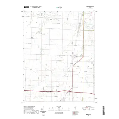
2021 Map of Irvington
USGS Topo · Published 2021About this map
Centralia and the adjacent community of Wamac anchor the northeastern corner of this Southern Illinois landscape, where the flat agricultural terrain is subdivided by a precise grid of rural routes like Sycamore Rd and Peach Tree Rd. The village of Irvington serves as a central hub for the surrounding countryside, situated near Grand Point Creek and the Irvington Cemetery. This survey highlights the complex boundary intersections of Marion, Washington, and Jefferson counties, illustrating how political lines bisect small settlements and farmsteads. Further south, the town of Richview sits along the rail corridor, while smaller named locales such as Noltings and Alda mark historically significant points in the rural landscape. Researchers will find a high density of named country roads and cemeteries, including Harres Cem and Grand Point Cem, which provide essential reference points for documenting local family heritage and early land divisions.
Find a feature on this map
81 named features on this map. Tap any name to fly to it.
Don’t see what you’re looking for? This feature index may not catch every label — zoom into the map to look around manually.
Map Details
Editions of this 2021 Irvington Map
This is the sole edition of this map. No revisions or reprints were ever made.
Other maps of this area

1910 · Carlyle
USGS Topo · 1:62,500

1914 · Centralia
USGS Topo · 1:62,500

1931 · Hoyleton
USGS Topo · 1:48,000

1932 · Nashville
USGS Topo · 1:62,500

1935 · Centralia
USGS Topo · 1:62,500

1936 · Nashville
USGS Topo · 1:62,500

1943 · Ashley
USGS Topo · 1:62,500

1946 · Ashley
USGS Topo · 1:62,500

1948 · Carlyle
USGS Topo · 1:62,500

1958 · Belleville
USGS Topo · 1:250,000