2023 Map of Irvona
USGS Topo · Published 2023About this map
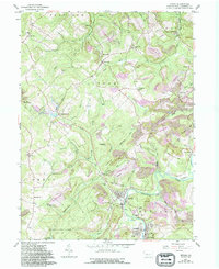
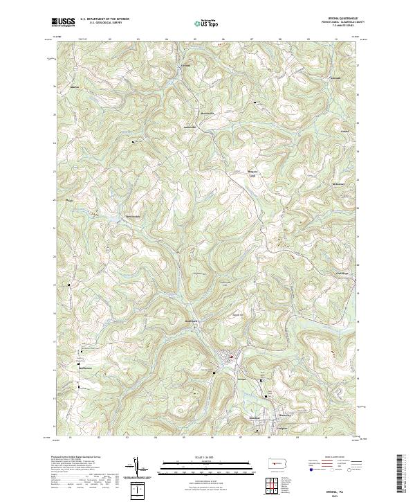
Clearfield Creek winds through the southern reaches of this landscape, anchoring a cluster of coal-country settlements including Irvona, Rosebud, Blain City, and Coalport. This 2023 survey of the northern Allegheny Plateau reveals a topography defined by sharp ridges and deep hollows, such as Dotts Hollow, and prominent elevations like Singleton Hill and Dickerman Hill. For genealogists and local researchers, the map is remarkably detailed in its recording of parish history and burial sites, including Saint Michaels Cem and the Harmony Chapel Cem.
Find a feature on this map
84 named features on this map. Tap any name to fly to it.
Don’t see what you’re looking for? This feature index may not catch every label — zoom into the map to look around manually.
Map Details
Editions of this 2023 Irvona Map
This is the sole edition of this map. No revisions or reprints were ever made.