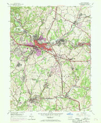
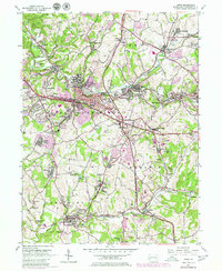
1953 Map of Irwin
USGS Topo · Published 1970About this map
Industrial Westmoreland County is defined here by the heavy presence of Penn Central rail lines and extensive mining operations during the mid-20th century. The landscape is a dense network of coal-related infrastructure, including coke ovens near Madison, various strip mines, and company settlements like Edna No 1 and Edna No 2. This era marks a significant point in the region's development, as seen in the purple-tinted urban expansions around Irwin and North Irwin that were documented during the 1969 photorevision.
Find a feature on this map
93 named features on this map. Tap any name to fly to it.
Don’t see what you’re looking for? This feature index may not catch every label — zoom into the map to look around manually.
Map Details
Editions of this 1953 Irwin Map
5 editions found
Other maps of this area

1902 · Brownsville
USGS Topo · 1:62,500

1902 · Connellsville
USGS Topo · 1:62,500

1904 · Mc Keesport
USGS Topo · 1:62,500

1904 · Greensburg
USGS Topo · 1:62,500

1906 · Brownsville
USGS Topo · 1:62,500

1906 · Greensburg
USGS Topo · 1:62,500

1907 · Pittsburg
USGS Topo · 1:62,500

1931 · Brownsville
USGS Topo · 1:62,500

1931 · Connellsville
USGS Topo · 1:62,500

1933 · Brownsville
USGS Topo · 1:62,500