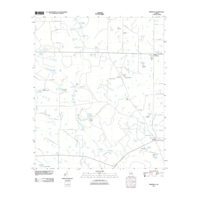
2011 Map of Irwinville
USGS Topo · Published 2011About this map
Irwinville serves as the focal point for this survey of Irwin County, where the Irwinville Post Office and Irwinville Cemetery sit near the junction of several regional routes. The landscape is defined by the wandering course of the Alapaha River and an extensive network of small lakes and ponds, many of which are managed by significant earthworks like McIntyre Lake Dam and Stripling Lake Dam. These water bodies, including Crystal Lake and Double Lakes, indicate a terrain shaped by both natural drainage and local agricultural or recreational water management.
Find a feature on this map
102 named features on this map. Tap any name to fly to it.
Don’t see what you’re looking for? This feature index may not catch every label — zoom into the map to look around manually.
Map Details
Editions of this 2011 Irwinville Map
This is the sole edition of this map. No revisions or reprints were ever made.
Other maps of this area

1953 · Waycross
USGS Topo · 1:250,000

1958 · Waycross
USGS Topo · 1:250,000

1973 · Ocilla West
USGS Topo · 1:24,000

1973 · Waterloo
USGS Topo · 1:24,000

1973 · Irwinville
USGS Topo · 1:24,000

1973 · Chula
USGS Topo · 1:24,000

1973 · Bethel
USGS Topo · 1:24,000

1973 · Fitzgerald West
USGS Topo · 1:24,000

1974 · Rebecca
USGS Topo · 1:24,000

1974 · Amboy
USGS Topo · 1:24,000