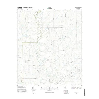
2017 Map of Irwinville
USGS Topo · Published 2017About this map
Irwinville and its surrounding countryside represent a classic South Georgia landscape of agricultural crossroads and scattered water bodies. The terrain is defined by the winding course of the Alapaha River and an extensive network of wetlands, ponds, and lakes, including the distinctive Tenmile Trail Lake and Boykin Ponds. The map reveals a high density of rural cemeteries like Oak Grove Cem and Big Creek Cem, which serve as vital markers for family history in this portion of the coastal plain. Transport patterns are tied to legacy routes such as the Rebecca Waterloo Hwy, while the Crystal Lake Airpark indicates the integration of aviation into the rural landscape. Small hubs like Lands Crossroads emphasize the enduring importance of historical junction points in this predominantly rural region.
Find a feature on this map
108 named features on this map. Tap any name to fly to it.
Don’t see what you’re looking for? This feature index may not catch every label — zoom into the map to look around manually.
Map Details
Editions of this 2017 Irwinville Map
This is the sole edition of this map. No revisions or reprints were ever made.
Other maps of this area

1953 · Waycross
USGS Topo · 1:250,000

1958 · Waycross
USGS Topo · 1:250,000

1973 · Ocilla West
USGS Topo · 1:24,000

1973 · Waterloo
USGS Topo · 1:24,000

1973 · Irwinville
USGS Topo · 1:24,000

1973 · Chula
USGS Topo · 1:24,000

1973 · Bethel
USGS Topo · 1:24,000

1973 · Fitzgerald West
USGS Topo · 1:24,000

1974 · Rebecca
USGS Topo · 1:24,000

1974 · Amboy
USGS Topo · 1:24,000