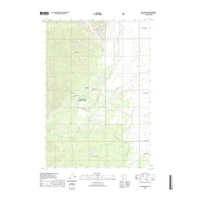
2020 Map of Isaac Meadows
USGS Topo · Published 2020About this map
Beaverhead National Forest encompasses the high-elevation drainage systems of the upper Ruby Cr and its many tributaries, including Sawmill Cr and Gary Cr. The landscape is defined by the prominent Badger Ridge and a series of deep gulches such as Nickel Bar Gulch, Portal Gulch, and Wenger Gulch. The settlement at Isaac Meadows sits centrally within this mountain terrain, accessed by the Gibbonsville Rd.
Find a feature on this map
33 named features on this map. Tap any name to fly to it.
Don’t see what you’re looking for? This feature index may not catch every label — zoom into the map to look around manually.
Map Details
Editions of this 2020 Isaac Meadows Map
This is the sole edition of this map. No revisions or reprints were ever made.
Other maps of this area

1955 · Dillon
USGS Topo · 1:250,000

1957 · Dillon
USGS Topo · 1:250,000

1958 · Dillon
USGS Topo · 1:250,000

1962 · Dillon
USGS Topo · 1:250,000
1965 · Dillon
USGS Topo · 1:250,000
1966 · Gibbons School
USGS Topo · 1:24,000
1966 · Shewag Lake
USGS Topo · 1:24,000
1966 · Big Hole Battlefield
USGS Topo · 1:24,000
1966 · Jumbo Mountain
USGS Topo · 1:24,000
1966 · Big Hole Pass
USGS Topo · 1:24,000