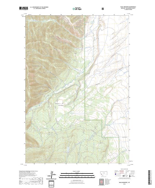
2024 Map of Isaac Meadows
USGS Topo · Published 2024About this map
Isaac Meadows occupies a high-elevation basin within the Beaverhead National Forest, defined by a complex network of headwater streams and mountain drainages. The landscape is characterized by prominent ridges such as Badger Ridge and a series of steep gulches, including Nickel Bar Gulch, Wenger Gulch, and Portal Gulch. These features channel water into significant tributaries like Butler Creek, Ruby Creek, and Sawpit Creek, which traverse the northern and western reaches of the quadrangle.
Find a feature on this map
28 named features on this map. Tap any name to fly to it.
Don’t see what you’re looking for? This feature index may not catch every label — zoom into the map to look around manually.
Map Details
Editions of this 2024 Isaac Meadows Map
This is the sole edition of this map. No revisions or reprints were ever made.
Other maps of this area

1955 · Dillon
USGS Topo · 1:250,000

1957 · Dillon
USGS Topo · 1:250,000

1958 · Dillon
USGS Topo · 1:250,000

1962 · Dillon
USGS Topo · 1:250,000

1965 · Dillon
USGS Topo · 1:250,000

1966 · Gibbons School
USGS Topo · 1:24,000

1966 · Shewag Lake
USGS Topo · 1:24,000

1966 · Big Hole Battlefield
USGS Topo · 1:24,000

1966 · Jumbo Mountain
USGS Topo · 1:24,000

1966 · Big Hole Pass
USGS Topo · 1:24,000