2021 Map of Isabel
USGS Topo · Published 2021About this map
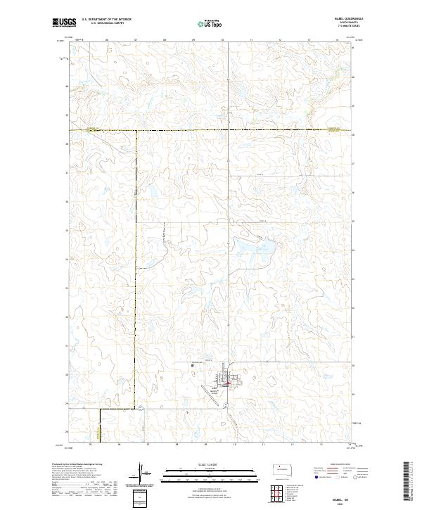
The town of Isabel serves as a focal point in this high-plains landscape where Dewey, Ziebach, and Corson Counties converge. The grid of the settlement is clearly defined by local thoroughfares such as Main St, E Idaho St, and N Madison Ave, reflecting its role as a regional center for the surrounding ranching and agricultural lands. Just north of the town center, Hillview Cem provides a point of interest for genealogists tracing the legacy of the area's early settlers, while the Isabel Municipal Airport marks its modern connection to the wider state.
Find a feature on this map
28 named features on this map. Tap any name to fly to it.
Don’t see what you’re looking for? This feature index may not catch every label — zoom into the map to look around manually.
Map Details
Editions of this 2021 Isabel Map
This is the sole edition of this map. No revisions or reprints were ever made.