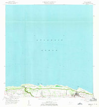
1960 Map of Isabela
USGS Topo · Published 1971About this map
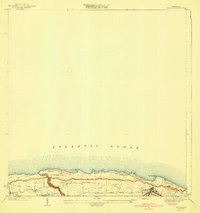
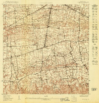
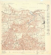
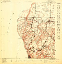
The northern shoreline of Puerto Rico is the focus of this 1960 revision, highlighting the coastal landscape of Isabela and the expansive military presence at Ramey Air Force Base. The map details the transition from the high grounds of Montaña down to the coastal flats of Bajura, where small settlements like Jobos and Bejucos are connected by a network of local roads. Of particular interest to local historians is the water management infrastructure, including the Tunel de Acueducto and the winding course of the Quebrada de los Cedros.
Find a feature on this map
22 named features on this map. Tap any name to fly to it.
Don’t see what you’re looking for? This feature index may not catch every label — zoom into the map to look around manually.
Map Details
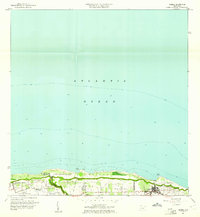
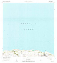
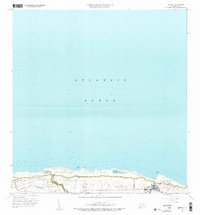
Editions of this 1960 Isabela Map
4 editions found
Other maps of this area

1937 · Aguadilla
USGS Topo · 1:20,000

1937 · Moca
USGS Topo · 1:20,000

1938 · Quebradillas
USGS Topo · 1:20,000

1941 · Moca
USGS Topo · 1:30,000
1941 · Isabela
USGS Topo · 1:30,000

1942 · Moca
USGS Topo · 1:30,000

1942 · Aguadilla
USGS Topo · 1:30,000
1950 · Moca NE
USGS Topo · 1:10,000
1950 · Quebradillas NO
USGS Topo · 1:10,000
1950 · Aguadilla NE
USGS Topo · 1:10,000
Featured Places
- Isabela, Isabela
- Sector Quique Bravo, Isabela
- Reparto Santa María, Isabela
- Jardín Miramar, Isabela
- Bajura, Isabela