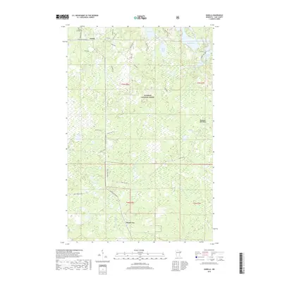
2019 Map of Isabella
USGS Topo · Published 2019About this map
Superior National Forest encompasses this stretch of Lake County, where small settlements like Isabella and Murphy City are connected by the winding path of Minnesota Highway 1. The landscape is a network of glacial lakes and headwaters, including the Little Isabella River and the branching Manitou River. Evidence of the region’s timber and rail history is seen in the naming of former railway grades and spurs, such as the General Grade and Wanless Spur M, which once served the logging industry. Local heritage is centered around the Isabella Memorial Cem and the rail-stop legacy at Manitou Junction. The map details a transition from the wetland-heavy areas around Crown Lake and Otter Lake to the more structured timber routes like the Timber Wolf Trail, reflecting the modern management of these Northwoods resources.
Find a feature on this map
41 named features on this map. Tap any name to fly to it.
Don’t see what you’re looking for? This feature index may not catch every label — zoom into the map to look around manually.
Map Details
Editions of this 2019 Isabella Map
This is the sole edition of this map. No revisions or reprints were ever made.
Other maps of this area

1954 · Silver Bay
USGS Topo · 1:62,500

1954 · Two Harbors
USGS Topo · 1:250,000

1955 · Isabella
USGS Topo · 1:62,500

1955 · Cramer
USGS Topo · 1:62,500

1956 · Finland
USGS Topo · 1:24,000

1956 · Finland
USGS Topo · 1:62,500

1957 · Two Harbors
USGS Topo · 1:250,000

1958 · Two Harbors
USGS Topo · 1:250,000

1964 · Two Harbors
USGS Topo · 1:250,000

1976 · Two Harbors
USGS Topo · 1:100,000