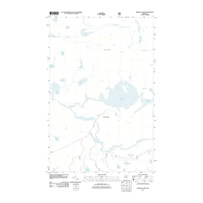
2011 Map of Isabella Lake
USGS Topo · Published 2011About this map
Forest Center serves as a primary point of human presence in this northern landscape, where a dense network of water bodies and waterways defines the movement through the terrain. The central Isabella Lake and its namesake Isabella River are flanked by numerous smaller lakes with distinctive names like Marathon Lake, Nine A M Lake, and Fallen Arch Lake. These water systems, including the Island River, suggest a region heavily shaped by its hydrology, likely serving as important routes for local travel and resource management in this part of Lake County.
Find a feature on this map
31 named features on this map. Tap any name to fly to it.
Don’t see what you’re looking for? This feature index may not catch every label — zoom into the map to look around manually.
Map Details
Editions of this 2011 Isabella Lake Map
This is the sole edition of this map. No revisions or reprints were ever made.
Other maps of this area

1954 · Two Harbors
USGS Topo · 1:250,000

1955 · Isabella
USGS Topo · 1:62,500

1955 · Cramer
USGS Topo · 1:62,500

1957 · Two Harbors
USGS Topo · 1:250,000

1958 · Two Harbors
USGS Topo · 1:250,000

1960 · Perent Lake
USGS Topo · 1:24,000

1960 · Alice Lake
USGS Topo · 1:24,000

1964 · Two Harbors
USGS Topo · 1:250,000
1981 · Snowbank Lake
USGS Topo · 1:24,000
1981 · Lake Insula
USGS Topo · 1:24,000