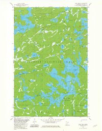
1981 Map of Lake Insula
USGS Topo · Published 1981About this map
Disappointment Mountain towers over a labyrinth of water and woods in this northern Minnesota wilderness during the early 1980s. The landscape is defined by the complex aquatic systems of the Kawishiwi River and the Portage River Rapids, which connect a dense network of lakes including Thomas Lake and Disappointment Lake. This area, managed within the Superior National Forest and Insula Lake State Forest, shows a terrain largely untouched by modern road infrastructure, instead relying on historic overland paths. These routes, such as the Kekekabic Trail, Snowbank Trail, and Old Pines Trail, provide the primary means of navigating between remote water bodies like Benezie Lake and Hudson Lake. The presence of several indefinite boundaries and numerous portages highlights the fluid, seasonal nature of travel through this glaciated terrain.
Find a feature on this map
56 named features on this map. Tap any name to fly to it.
Don’t see what you’re looking for? This feature index may not catch every label — zoom into the map to look around manually.
Map Details
Editions of this 1981 Lake Insula Map
2 editions found
Other maps of this area

1954 · Two Harbors
USGS Topo · 1:250,000

1957 · Two Harbors
USGS Topo · 1:250,000

1957 · Ensign Lake
USGS Topo · 1:62,500

1957 · Quetico
USGS Topo · 1:250,000

1958 · Two Harbors
USGS Topo · 1:250,000

1959 · Kekekabic Lake
USGS Topo · 1:24,000

1960 · Perent Lake
USGS Topo · 1:24,000

1960 · Alice Lake
USGS Topo · 1:24,000

1964 · Two Harbors
USGS Topo · 1:250,000

1968 · Quetico
USGS Topo · 1:250,000