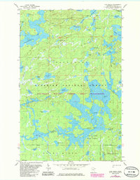
1981 Map of Lake Insula
USGS Topo · Published 1986About this map
Disappointment Mountain and the sprawling waters of the Boundary Waters Canoe Area Wilderness anchor this northern Minnesota landscape. In the early 1980s, the terrain was defined by an intricate network of glacial lakes and portages, including Disappointment Lake and the expansive Lake Insula. The map shows a region almost entirely devoid of permanent structures, instead highlighting the primitive travel routes that shaped human interaction with the wilderness. The Kawishiwi River flows through the central portion of the sheet, connecting major water bodies like Hudson Lake. Notable land features such as Williamson Island and The Rock provide specific navigational points for those traversing the Superior National Forest. Historic paths like the Snowbank Trail and Old Pines Trail represent the terrestrial links between these diverse aquatic systems, including smaller named basins such as Museum Lake and Starlight Lake.
Find a feature on this map
51 named features on this map. Tap any name to fly to it.
Don’t see what you’re looking for? This feature index may not catch every label — zoom into the map to look around manually.
Map Details
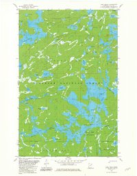
Editions of this 1981 Lake Insula Map
2 editions found
Other maps of this area

1954 · Two Harbors
USGS Topo · 1:250,000

1957 · Two Harbors
USGS Topo · 1:250,000

1957 · Ensign Lake
USGS Topo · 1:62,500

1957 · Quetico
USGS Topo · 1:250,000

1958 · Two Harbors
USGS Topo · 1:250,000

1959 · Kekekabic Lake
USGS Topo · 1:24,000

1960 · Perent Lake
USGS Topo · 1:24,000

1960 · Alice Lake
USGS Topo · 1:24,000

1964 · Two Harbors
USGS Topo · 1:250,000

1968 · Quetico
USGS Topo · 1:250,000