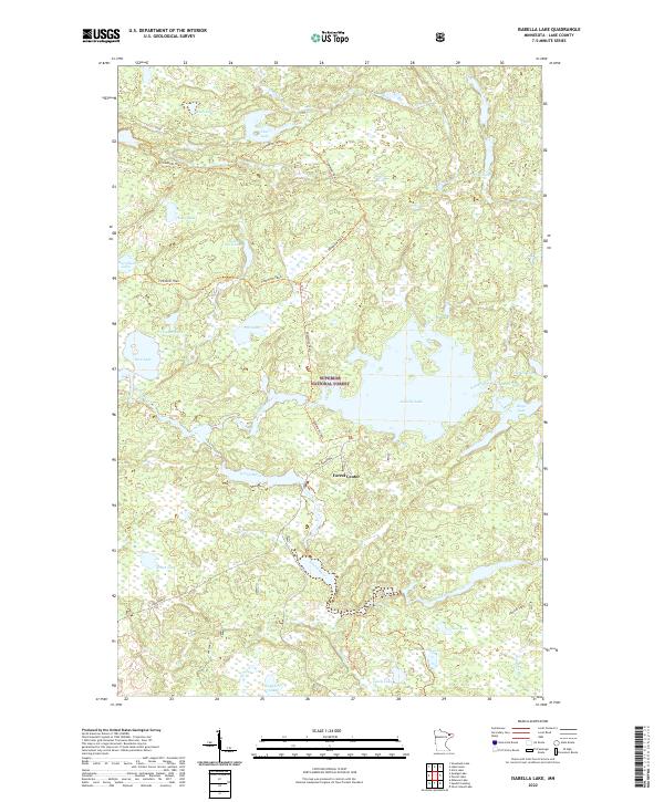
2022 Map of Isabella Lake
USGS Topo · Published 2022About this map
Superior National Forest encompasses this wilderness region of Lake County, where the dense network of glacial lakes and river systems dictates the landscape. The small settlement of Forest Center sits south of the massive Isabella Lake, serving as a localized point of human activity within an otherwise intricate web of waterways. The Isabella River and Island River provide significant drainage through the timbered terrain, connecting various water bodies such as Marathon Lake, Rice Lake, and the curiously named Nine A M Lake.
Find a feature on this map
34 named features on this map. Tap any name to fly to it.
Don’t see what you’re looking for? This feature index may not catch every label — zoom into the map to look around manually.
Map Details
Editions of this 2022 Isabella Lake Map
This is the sole edition of this map. No revisions or reprints were ever made.
Other maps of this area

1954 · Two Harbors
USGS Topo · 1:250,000

1955 · Isabella
USGS Topo · 1:62,500

1955 · Cramer
USGS Topo · 1:62,500

1957 · Two Harbors
USGS Topo · 1:250,000

1958 · Two Harbors
USGS Topo · 1:250,000

1960 · Perent Lake
USGS Topo · 1:24,000

1960 · Alice Lake
USGS Topo · 1:24,000

1964 · Two Harbors
USGS Topo · 1:250,000
1981 · Snowbank Lake
USGS Topo · 1:24,000
1981 · Lake Insula
USGS Topo · 1:24,000