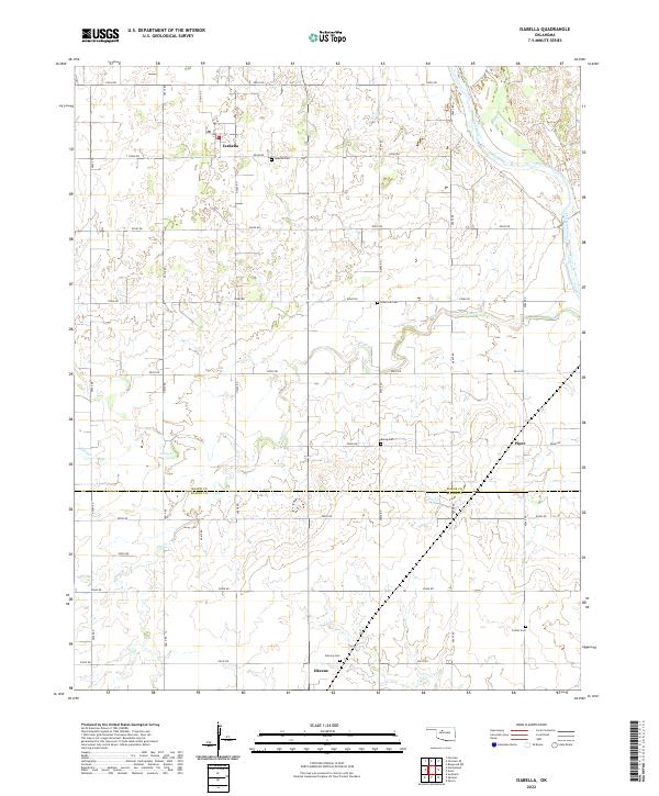
2022 Map of Isabella
USGS Topo · Published 2022About this map
The Isabella settlement and surrounding agricultural lands in Major County define this prairie landscape, where the Cimarron River cuts through the northeastern corner. The area is marked by a network of rural section-line roads, such as e0540 RD and n2615 RD, which serve a territory dotted with long-standing family and community landmarks. Genealogists and local historians can trace several burial grounds across the terrain, including Isabella Cem, Americus Cem, and Bierig Cem. South of the Major Co and Blaine Co line, the map transitions toward the northern outskirts of Okeene, revealing a pattern of drainage through waterways like Deep Cr, Sand Cr, and Elm Cr. This survey illustrates the persistent rural structure of Oklahoma’s wheat belt, where small community centers like Isabella and Piper remain vital focal points for the surrounding township grids.
Find a feature on this map
36 named features on this map. Tap any name to fly to it.
Don’t see what you’re looking for? This feature index may not catch every label — zoom into the map to look around manually.
Map Details
Editions of this 2022 Isabella Map
This is the sole edition of this map. No revisions or reprints were ever made.
Other maps of this area

1893 · Ames
USGS Topo · 1:62,500

1955 · Woodward
USGS Topo · 1:250,000

1956 · Ames
USGS Topo · 1:62,500

1956 · Ringwood
USGS Topo · 1:62,500

1958 · Woodward
USGS Topo · 1:250,000

1969 · Fairview SE
USGS Topo · 1:24,000

1969 · Fairview
USGS Topo · 1:24,000

1972 · Southard
USGS Topo · 1:24,000

1972 · Okeene
USGS Topo · 1:24,000

1972 · Homestead
USGS Topo · 1:24,000