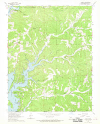
1968 Map of Isabella
USGS Topo · Published 1970About this map
The waters of Bull Shoals Lake dominate this Ozark landscape, flooding the deep valleys where the Little North Fork White River and its many tributaries once ran free. Surveyed in the late 1960s, the map captures the transition of this area into a recreational hub, indicated by the Public Use Area Boat Ramp near Pontiac. Despite the inundation, historical upland settlements like Isabella remain, situated among numerous named hollows such as Jackson Hollow and Keiton Hollow. Local heritage is well-preserved through several family-named burial sites including Friend Cem, Wolf Cem, and Turnbull Cem. The northern portion of the map is defined by the Mark Twain National Forest Boundary, while high points like Wilkinson Knob provide context to the area's elevation before the terrain descends into the branching fingers of the reservoir.
Find a feature on this map
38 named features on this map. Tap any name to fly to it.
Don’t see what you’re looking for? This feature index may not catch every label — zoom into the map to look around manually.
Map Details
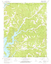
Editions of this 1968 Isabella Map
2 editions found
Other maps of this area

1890 · Mountain Home
USGS Topo · 1:125,000

1891 · Mountain Home
USGS Topo · 1:125,000

1893 · Yellville
USGS Topo · 1:125,000

1894 · Mountain Home
USGS Topo · 1:125,000

1903 · Yellville
USGS Topo · 1:125,000

1905 · Yellville
USGS Topo · 1:125,000

1929 · Yellville
USGS Topo · 1:125,000

1934 · Gainesville
USGS Topo · 1:48,000

1936 · Thornfield
USGS Topo · 1:48,000

1940 · Gainesville
USGS Topo · 1:62,500