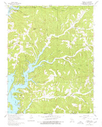
1968 Map of Isabella
USGS Topo · Published 1980About this map
Bull Shoals Lake dominates the western landscape of this 1968 survey, its fingers reaching deep into the winding hollows of the Ozarks. The settlement patterns shown here reflect a community tied to the rising waters and the surrounding Mark Twain National Forest. Near the southern edge of the sheet, Pontiac serves as a local hub with its Public Use Area, boat ramps, and the nearby Pontiac Ch. Further north, Isabella sits at the junction of Highway 160 and HH, surrounded by family-named landmarks like Wilkinson Knob and Wells Hollow.
Find a feature on this map
45 named features on this map. Tap any name to fly to it.
Don’t see what you’re looking for? This feature index may not catch every label — zoom into the map to look around manually.
Map Details
Editions of this 1968 Isabella Map
2 editions found
Other maps of this area

1890 · Mountain Home
USGS Topo · 1:125,000

1891 · Mountain Home
USGS Topo · 1:125,000

1893 · Yellville
USGS Topo · 1:125,000

1894 · Mountain Home
USGS Topo · 1:125,000

1903 · Yellville
USGS Topo · 1:125,000

1905 · Yellville
USGS Topo · 1:125,000

1929 · Yellville
USGS Topo · 1:125,000

1934 · Gainesville
USGS Topo · 1:48,000

1936 · Thornfield
USGS Topo · 1:48,000

1940 · Gainesville
USGS Topo · 1:62,500