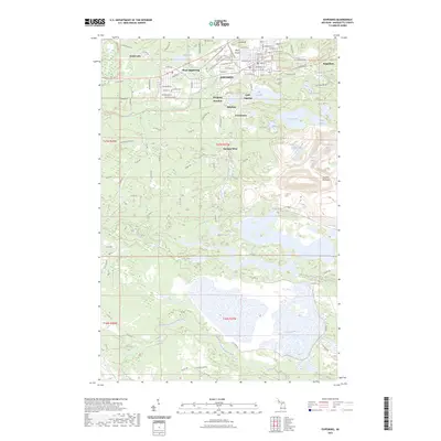
2023 Map of Ishpeming
USGS Topo · Published 2023About this map
Ishpeming and neighboring Negaunee anchor this study of Michigan’s iron range, where the urban grid meets a landscape heavily shaped by its mining heritage. The area between these centers is dotted with distinct historical settlements such as National Mine, Salisbury, and Frenchtown, reflecting the clustered growth pattern of the Marquette Iron Range. Significant elevation changes are marked by landmarks like Pilot Knob and Summit Mountain, while the industrial and social history of the region is traced through the Ishpeming-To-Republic Route Trl, which follows the path of former rail connections essential to the ore trade.
Find a feature on this map
114 named features on this map. Tap any name to fly to it.
Don’t see what you’re looking for? This feature index may not catch every label — zoom into the map to look around manually.
Map Details
Editions of this 2023 Ishpeming Map
This is the sole edition of this map. No revisions or reprints were ever made.
Other maps of this area

1952 · Ishpeming
USGS Topo · 1:62,500

1952 · Ishpeming
USGS Topo · 1:24,000

1952 · Palmer
USGS Topo · 1:24,000

1953 · Negaunee
USGS Topo · 1:24,000

1954 · Negaunee SW
USGS Topo · 1:24,000

1954 · Negaunee
USGS Topo · 1:62,500

1955 · Diorite
USGS Topo · 1:24,000

1955 · Greenwood
USGS Topo · 1:24,000

1955 · Republic
USGS Topo · 1:62,500

1955 · Champion
USGS Topo · 1:62,500