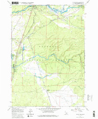
1964 Map of Island Park
USGS Topo · Published 1986About this map
Henrys Fork and the Buffalo River converge in this mid-1960s survey of the high mountain country within Targhee National Forest. The landscape is defined by the intersection of water and rail, with the Union Pacific line tracking southward toward the Island Park Siding. Small enclaves of settlement and commerce appear at Trude and Macks Inn PO, while the Island Park Ranger Station and Flat Rock Guard Sta mark the administrative presence in this timber and recreation corridor. The map details a transition from river-bottom wetlands to rising forest, noting numerous unnamed springs and localized industry at various Gravel Pits. Recreational development is evident near the Island Park Reservoir, where sites like Upper Coffee Pot Campground and Buffalo Campground cater to the era's growing outdoor tourism.
Find a feature on this map
32 named features on this map. Tap any name to fly to it.
Don’t see what you’re looking for? This feature index may not catch every label — zoom into the map to look around manually.
Map Details
Editions of this 1964 Island Park Map
3 editions found
Other maps of this area

1955 · Ashton
USGS Topo · 1:250,000

1957 · Buffalo Lake
USGS Topo · 1:62,500

1958 · Ashton
USGS Topo · 1:250,000

1958 · West Yellowstone
USGS Topo · 1:62,500

1960 · Ashton
USGS Topo · 1:250,000

1964 · Hatchery Butte
USGS Topo · 1:24,000

1964 · Island Park
USGS Topo · 1:24,000

1964 · Island Park Dam
USGS Topo · 1:24,000

1964 · Sawtell PK
USGS Topo · 1:24,000

1964 · Big Springs
USGS Topo · 1:24,000