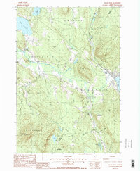
1988 Map of Island Pond
USGS Topo · Published 1988About this map
Island Pond serves as the focal point for this section of the Northeast Kingdom, situated at the junction of the Clyde River and several mountain streams. The terrain is defined by significant elevations such as Bluff Mountain and Bald Mountain, the latter topped by the Bald Mtn Lookout Tower. The landscape reflects a mix of rugged timberland and highland water bodies, including Echo Lake and the western edge of Seymour Lake. To the south, the Willoughby State Forest protects the high ground around Jobs Mtn and Jobs Pond. The settlement at East Charleston and the presence of Gravel Pits indicate localized industry and community nodes amidst the heavy forest cover and glacial lakes. This 1980s data highlights the enduring rural character of Essex County, where the hydrological network of Pherrins River and Webster Brook drains the interior valleys.
Find a feature on this map
54 named features on this map. Tap any name to fly to it.
Don’t see what you’re looking for? This feature index may not catch every label — zoom into the map to look around manually.
Map Details
Editions of this 1988 Island Pond Map
2 editions found
Other maps of this area

1919 · Lake Memphremagog
USGS Topo · 1:62,500

1920 · Derby
USGS Topo · 1:62,500

1923 · Lake Memphremagog
USGS Topo · 1:48,000

1924 · Island Pond
USGS Topo · 1:48,000

1925 · Memphremagog
USGS Topo · 1:62,500

1926 · Island Pond
USGS Topo · 1:62,500

1935 · Lyndonville
USGS Topo · 1:48,000

1939 · Lyndonville
USGS Topo · 1:62,500

1950 · Lake Champlain
USGS Topo · 1:250,000

1950 · Lewiston
USGS Topo · 1:250,000