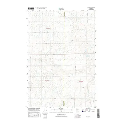
2016 Map of Isle SW
USGS Topo · Published 2016About this map
The Knife River meanders through this portion of the Minnesota lake country, defining much of the drainage pattern across the Mille Lacs and Kanabec County line. This landscape is shaped by water management and wetland systems, featuring several localized reservoirs and pools such as Ernst Pool and the Louis Richards Reservoir. The presence of the Bergstedt Dam along the southern reaches of the river highlights 21st-century efforts to control water flow in this flat, marshy terrain. The area is gridded by a network of rural routes including Red Rd, Woods Rd, and Munkelwitz Rd, which provide access to the townships of t42n r25w and t41n r24w. This survey provides a clear view of how modern rural land divisions and township boundaries interact with the natural courses of the Little Ann River and its tributaries.
Find a feature on this map
33 named features on this map. Tap any name to fly to it.
Don’t see what you’re looking for? This feature index may not catch every label — zoom into the map to look around manually.
Map Details
Editions of this 2016 Isle SW Map
This is the sole edition of this map. No revisions or reprints were ever made.
Other maps of this area

1953 · Duluth
USGS Topo · 1:250,000

1953 · Stillwater
USGS Topo · 1:250,000

1955 · Stillwater
USGS Topo · 1:250,000

1958 · Stillwater
USGS Topo · 1:250,000

1958 · Duluth
USGS Topo · 1:250,000

1965 · Stillwater
USGS Topo · 1:250,000

1968 · Milaca NE
USGS Topo · 1:24,000

1968 · Ann Lake
USGS Topo · 1:24,000

1968 · Isle SW
USGS Topo · 1:24,000

1968 · Wahkon North
USGS Topo · 1:24,000