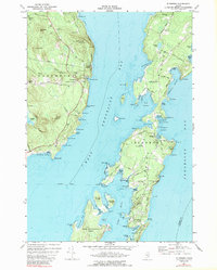
1973 Map of Islesboro
USGS Topo · Published 1989About this map
West Penobscot Bay separates the mainland community of Northport from the linear expanse of Islesboro in this coastal 1970s survey. The island landscape is defined by its maritime connections, anchored by the Islesboro Ferry and the Islesboro Municipal Airport. Evidence of early settlement and local genealogy is found at the Saturday Cove Cem on the mainland and numerous small family-named landmarks like Pendleton Abrams Mtn and Mt Percival across the water. The intricate shoreline of Gilkey Harbor and Sabbathday Harbor reveals a world of tidal flats and points, from Gooseberry Pt to the secluded enclave of Dark Harbor. In the northwest, the Durham State Forest provides a contrast to the coastal developments of Temple Heights and the working gravel pits that supported the region's mid-century infrastructure.
Find a feature on this map
101 named features on this map. Tap any name to fly to it.
Don’t see what you’re looking for? This feature index may not catch every label — zoom into the map to look around manually.
Map Details
Editions of this 1973 Islesboro Map
2 editions found
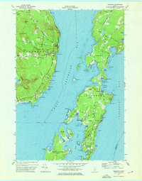
Other maps of this area

1902 · Castine
USGS Topo · 1:62,500

1904 · Castine
USGS Topo · 1:62,500

1904 · Vinalhaven
USGS Topo · 1:62,500

1904 · Rockland
USGS Topo · 1:62,500

1905 · Penobscot Bay
USGS Topo · 1:125,000

1906 · Rockland
USGS Topo · 1:62,500

1915 · Belfast
USGS Topo · 1:62,500

1917 · Belfast
USGS Topo · 1:62,500

1941 · Belfast
USGS Topo · 1:62,500

1941 · Rockland
USGS Topo · 1:62,500