
1910 Map of Isleton
USGS Topo · Published 1910About this map
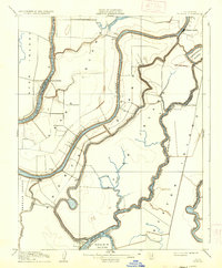
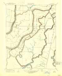
The low-lying islands of the California Delta dominate this 1910 survey, showcasing a complex network of waterways that defined early Sacramento Valley commerce. Isleton and Walnut Grove appear as vital riverfront hubs during a period when the delta was being aggressively reclaimed for agriculture. The map illustrates the intensive levee and drainage systems required to transform places like Andrus Island, Grand Island, and Staten Island into productive farmland.
Find a feature on this map
27 named features on this map. Tap any name to fly to it.
Don’t see what you’re looking for? This feature index may not catch every label — zoom into the map to look around manually.
Map Details
Editions of this 1910 Isleton Map
3 editions found
Other maps of this area

1894 · Lodi
USGS Topo · 1:125,000

1908 · Courtland
USGS Topo · 1:62,500

1910 · New Hope
USGS Topo · 1:31,680

1910 · Rio Vista
USGS Topo · 1:31,680

1910 · Bouldin
USGS Topo · 1:31,680

1910 · Jersey
USGS Topo · 1:31,680

1910 · Bruceville
USGS Topo · 1:31,680

1910 · Headreach
USGS Topo · 1:31,680

1916 · Cache Slough
USGS Topo · 1:31,680

1916 · Vorden
USGS Topo · 1:31,680