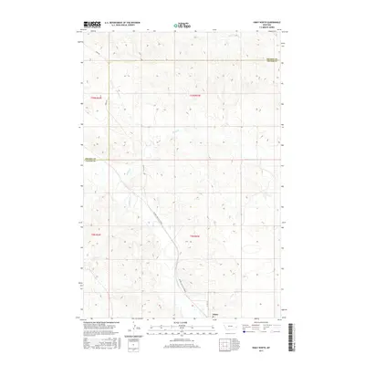
2017 Map of Ismay North
USGS Topo · Published 2017About this map
O'Fallon Cr flows through this expansive section of Eastern Montana, defining the drainages across the Prairie Co Custer Co line. The landscape is marked by a series of branching waterways, including Pennel Cr, Lone Tree Cr, and Malone Cr, which illustrate the complex local hydrology south of Pine Cr. A distinct transportation network connects the remote area, anchored by the town of Ismay at the southern edge of the quadrangle. The descriptive Mildred Ismay Cut Across and Ismay Rd serve as primary arteries through the township divisions of t10n r54e, t10n r55e, and t9n r55e, showing how the rural road system follows the natural contours of the Montana plains.
Find a feature on this map
15 named features on this map. Tap any name to fly to it.
Don’t see what you’re looking for? This feature index may not catch every label — zoom into the map to look around manually.
Map Details
Editions of this 2017 Ismay North Map
This is the sole edition of this map. No revisions or reprints were ever made.
Other maps of this area
1953 · Miles City
USGS Topo · 1:250,000
1957 · Miles City
USGS Topo · 1:250,000
1958 · Miles City
USGS Topo · 1:250,000
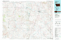
1981 · Baker
USGS Topo · 1:100,000
1981 · Mildred NE
USGS Topo · 1:24,000
1981 · Bracket Butte
USGS Topo · 1:24,000
1981 · Loony Hollow
USGS Topo · 1:24,000
1981 · Ismay North
USGS Topo · 1:24,000
1981 · Dorothy Draw
USGS Topo · 1:24,000
1981 · Ayer Spring
USGS Topo · 1:24,000