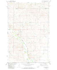
1981 Map of Ismay North
USGS Topo · Published 1981About this map
The Chicago Milwaukee St Paul and Pacific railroad cuts a diagonal path through this Montana landscape, connecting the small settlement of Ismay to the wider region. This 1981 survey documents the semi-arid drainages where O'Fallon Creek meets tributaries like Pennel Creek, Ash Creek, and Malone Creek. The terrain is marked by the presence of several Flowing Wells and resource extraction sites, including a Drill Hole and multiple Gravel Pits. A notable Pipeline and a Storage Bin suggest the area's role in industrial transport and agricultural storage. The county line between Prairie Co and Custer Co bisects the northern section of the map, illustrating the administrative divisions of this ranching and rail territory.
Find a feature on this map
14 named features on this map. Tap any name to fly to it.
Don’t see what you’re looking for? This feature index may not catch every label — zoom into the map to look around manually.
Map Details
Editions of this 1981 Ismay North Map
This is the sole edition of this map. No revisions or reprints were ever made.
Other maps of this area

1953 · Miles City
USGS Topo · 1:250,000

1957 · Miles City
USGS Topo · 1:250,000

1958 · Miles City
USGS Topo · 1:250,000

1981 · Baker
USGS Topo · 1:100,000

1981 · Mildred NE
USGS Topo · 1:24,000
1981 · Bracket Butte
USGS Topo · 1:24,000
1981 · Loony Hollow
USGS Topo · 1:24,000

1981 · Dorothy Draw
USGS Topo · 1:24,000

1981 · Ayer Spring
USGS Topo · 1:24,000
1981 · Mildred
USGS Topo · 1:24,000