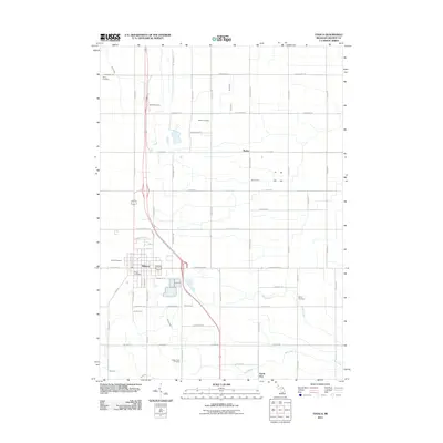
2011 Map of Ithaca
USGS Topo · Published 2011About this map
The Gratiot County seat of Ithaca anchors this survey of central Michigan farmland, situated at the junction of several regional transit routes. The landscape is defined by its rectilinear grid of section roads and a series of rural waterways, including Brady Creek, Horse Creek, and the Bad River which flows along the southern edge. For genealogists and local historians, the sheet provides a detailed distribution of family and community burial sites, from the prominent Ithaca Cemetery to smaller rural locations like Beebe Cemetery, Brady Cemetery, and the Staton Farm Cemetery. Small settlements and landmarks like Beebe, the southern outskirts of North Star, and the Ithaca Post Office illustrate the 21st-century footprint of these agricultural communities. The presence of the Ithaca Rest Area along the highway further indicates the importance of modern infrastructure to the local economy while maintaining its traditional rural character.
Find a feature on this map
60 named features on this map. Tap any name to fly to it.
Don’t see what you’re looking for? This feature index may not catch every label — zoom into the map to look around manually.
Map Details
Editions of this 2011 Ithaca Map
This is the sole edition of this map. No revisions or reprints were ever made.
Other maps of this area

1918 · Elsie
USGS Topo · 1:62,500

1918 · Perrinton
USGS Topo · 1:62,500

1934 · Merrill
USGS Topo · 1:62,500

1935 · Alma
USGS Topo · 1:62,500

1937 · Merrill
USGS Topo · 1:62,500

1938 · Alma
USGS Topo · 1:62,500

1943 · Perrinton
USGS Topo · 1:62,500

1943 · Elsie
USGS Topo · 1:62,500

1954 · Midland
USGS Topo · 1:250,000

1958 · Midland
USGS Topo · 1:250,000