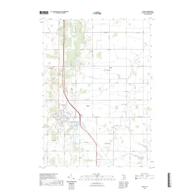
2023 Map of Ithaca
USGS Topo · Published 2023About this map
The Gratiot County Courthouse stands as the central landmark of Ithaca, Michigan, serving as the focal point for this agrarian landscape in the early 21st century. The town is laid out on a traditional grid, bordered by watercourses like Beaver Drain and Shad Creek that feed into the larger Bad River system to the south. The surrounding countryside is defined by a dense network of sectional roads such as W Van Buren Rd and N State Rd, which provide access to scattered rural settlements like Beebe.
Find a feature on this map
81 named features on this map. Tap any name to fly to it.
Don’t see what you’re looking for? This feature index may not catch every label — zoom into the map to look around manually.
Map Details
Editions of this 2023 Ithaca Map
This is the sole edition of this map. No revisions or reprints were ever made.
Other maps of this area

1918 · Elsie
USGS Topo · 1:62,500

1918 · Perrinton
USGS Topo · 1:62,500

1934 · Merrill
USGS Topo · 1:62,500

1935 · Alma
USGS Topo · 1:62,500

1937 · Merrill
USGS Topo · 1:62,500

1938 · Alma
USGS Topo · 1:62,500

1943 · Perrinton
USGS Topo · 1:62,500

1943 · Elsie
USGS Topo · 1:62,500

1954 · Midland
USGS Topo · 1:250,000

1958 · Midland
USGS Topo · 1:250,000