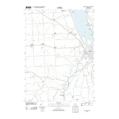
2010 Map of Ithaca West
USGS Topo · Published 2010About this map
The western edges of Ithaca and the steep slopes descending toward the southern tip of Cayuga Lake characterize this landscape. The terrain is deeply incised by watercourses like Enfield Creek and Cliff Park Brook, which carve through the plateau toward the Cayuga Inlet. The map reveals a high concentration of established institutions and community landmarks, including the Tompkins County Home, the Independent Order of Odd Fellows Home, and Neno International Airport.
Find a feature on this map
105 named features on this map. Tap any name to fly to it.
Don’t see what you’re looking for? This feature index may not catch every label — zoom into the map to look around manually.
Map Details
Editions of this 2010 Ithaca West Map
This is the sole edition of this map. No revisions or reprints were ever made.
Other maps of this area

1893 · Ithaca
USGS Topo · 1:62,500

1895 · Ithaca
USGS Topo · 1:62,500

1898 · Moravia
USGS Topo · 1:62,500

1900 · Dryden
USGS Topo · 1:62,500

1902 · Moravia
USGS Topo · 1:62,500

1902 · Genoa
USGS Topo · 1:62,500

1905 · Watkins Glen
USGS Topo · 1:125,000

1906 · Catatonk
USGS Topo · 1:125,000

1942 · Ludlowville
USGS Topo · 1:24,000

1942 · Trumansburg
USGS Topo · 1:24,000