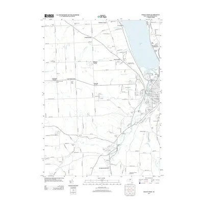
2013 Map of Ithaca West
USGS Topo · Published 2013About this map
Cayuga Lake defines the northeastern edge of this Ithaca region, where the terrain transitions from the water's edge at Esty Point and McKinneys Point to the elevated plateaus and agricultural stretches of western Tompkins County. The landscape is deeply carved by watercourses like Enfield Cr and Cascadilla Cr, which create dramatic features such as Lucifer Falls and the ravines of Buttermilk Falls State Park. These natural drainages dictated the early road patterns and the placement of historic corners, including Krum Corner, Hayt Corner, and Applegate Corner. Residential expansion is visible through developments like Meadowbrook Park and Glenwood Heights, yet large institutions remains prominent, including the Tompkins County Home and the Independent Order of Odd Fellows Home. Small family and community histories are preserved in numerous burial grounds, from the Quaker Cem in the northwest to Kings Cem in the southeast.
Find a feature on this map
171 named features on this map. Tap any name to fly to it.
Don’t see what you’re looking for? This feature index may not catch every label — zoom into the map to look around manually.
Map Details
Editions of this 2013 Ithaca West Map
This is the sole edition of this map. No revisions or reprints were ever made.
Other maps of this area

1893 · Ithaca
USGS Topo · 1:62,500

1895 · Ithaca
USGS Topo · 1:62,500

1898 · Moravia
USGS Topo · 1:62,500

1900 · Dryden
USGS Topo · 1:62,500

1902 · Moravia
USGS Topo · 1:62,500

1902 · Genoa
USGS Topo · 1:62,500

1905 · Watkins Glen
USGS Topo · 1:125,000

1906 · Catatonk
USGS Topo · 1:125,000

1942 · Ludlowville
USGS Topo · 1:24,000

1942 · Trumansburg
USGS Topo · 1:24,000