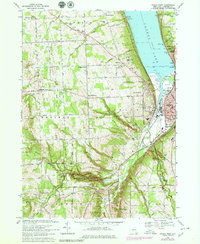
1978 Map of Ithaca West
USGS Topo · Published 1979About this map
Cayuga Lake defines the eastern boundary of this landscape, where the plateau drops sharply toward the water through steep-walled ravines like Coy Glen and Enfield Creek. The map documents a rural network of crossroads and family settlements, such as Quaker Settlement and Kennedy Corner, that persist alongside the growing western edges of Ithaca. The southern portion of the sheet is dominated by the dramatic topography of Robert H Treman State Park, featuring Lucifer Falls, and Buttermilk Falls State Park. This 1978 revision captures the area's transition, showing established institutions like the County Home and IOOF Home near the lake, while highlighting transportation changes as the Conrail line skirts the waterfront. The land remains largely agricultural and forested between the deep glens, marked by several historic burying grounds including Burdick Hill Cem and Quaker Settlement Cem.
Find a feature on this map
88 named features on this map. Tap any name to fly to it.
Don’t see what you’re looking for? This feature index may not catch every label — zoom into the map to look around manually.
Map Details
Editions of this 1978 Ithaca West Map
This is the sole edition of this map. No revisions or reprints were ever made.
Other maps of this area

1893 · Ithaca
USGS Topo · 1:62,500

1895 · Ithaca
USGS Topo · 1:62,500

1898 · Moravia
USGS Topo · 1:62,500

1900 · Dryden
USGS Topo · 1:62,500

1902 · Moravia
USGS Topo · 1:62,500

1902 · Genoa
USGS Topo · 1:62,500

1905 · Watkins Glen
USGS Topo · 1:125,000

1906 · Catatonk
USGS Topo · 1:125,000

1942 · Ludlowville
USGS Topo · 1:24,000

1942 · Trumansburg
USGS Topo · 1:24,000