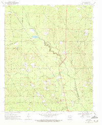
1969 Map of Ivan
USGS Topo · Published 1972About this map
Moro Creek winds through the heart of this landscape, forming the natural boundary between Dallas and Cleveland Counties. In the late 1960s, this region was defined by small rural hubs and an active rail line, with the Chicago Rock Island and Pacific railroad bisecting the territory. The settlement of Ivan sits near the crossing of this railroad and Highway 167, supported by local landmarks like a Roadside Park. To the northwest, the community of Bunn is positioned along the same tracks near the Dallas County line.
Find a feature on this map
38 named features on this map. Tap any name to fly to it.
Don’t see what you’re looking for? This feature index may not catch every label — zoom into the map to look around manually.
Map Details
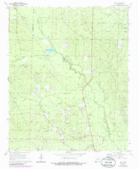
Editions of this 1969 Ivan Map
2 editions found
Other maps of this area

1903 · Camden
USGS Topo · 1:125,000

1953 · El Dorado
USGS Topo · 1:250,000

1955 · Little Rock
USGS Topo · 1:250,000

1956 · Little Rock
USGS Topo · 1:250,000

1957 · El Dorado
USGS Topo · 1:250,000

1958 · El Dorado
USGS Topo · 1:250,000

1960 · El Dorado
USGS Topo · 1:250,000

1960 · Little Rock
USGS Topo · 1:250,000

1964 · Little Rock
USGS Topo · 1:250,000

1964 · Staves
USGS Topo · 1:24,000