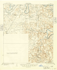
1931 Map of Ivan
USGS Topo · Published 1949About this map
The Brazos River winds through this North Texas landscape, defining the boundaries and topography between Young, Stephens, and Palo Pinto counties during the mid-1920s. The river's serpentine course creates prominent geographical features like Brier Bend and Herron Bend, while the surrounding terrain is marked by a network of drainage systems including Caddo Creek and Fox Hollow Creek. Small rural communities and rural schoolhouses anchor the region, illustrating the early 20th-century settlement patterns of the Texas prairie.
Find a feature on this map
53 named features on this map. Tap any name to fly to it.
Don’t see what you’re looking for? This feature index may not catch every label — zoom into the map to look around manually.
Map Details
Editions of this 1931 Ivan Map
2 editions found

Other maps of this area

1890 · Breckenridge
USGS Topo · 1:125,000

1891 · Palo Pinto
USGS Topo · 1:125,000

1918 · Palo Pinto
USGS Topo · 1:125,000

1924 · Breckenridge 1-a
USGS Topo · 1:48,000

1924 · Palo Pinto 2-b
USGS Topo · 1:48,000

1924 · Graham 4-d
USGS Topo · 1:48,000

1924 · Palo Pinto 2-c
USGS Topo · 1:48,000

1924 · Breckenridge 1-d
USGS Topo · 1:48,000

1925 · Graham 4-c
USGS Topo · 1:48,000

1925 · Breckenridge 1-b
USGS Topo · 1:48,000